Lynker Technologies, Lynker Analytics and the Colorado Natural Heritage Program (CNHP) at Colorado State University, have been commissioned to identify and map changes in valley floor wetlands and beaver ponds throughout the Colorado River Basin over the past decade. The project is sponsored by the Walton Family Foundation’s Environment Program, which works to protect and support a climate-resilient and healthy Colorado River Basin where nature and communities thrive together.
Freshwater wetlands have been rated as the world’s most valuable land-based ecosystem. They soak up floodwaters, alleviate droughts, reduce erosion, sequester carbon and provide habitat for fish, wildlife and plants.
By creating dams that trap sediment and slow water flow, beavers reliably and economically maintain wetlands in North America. By one estimate, as much as one meter of sediment per year is caught behind beaver dams, and some sites can be occupied for up to fifty years.
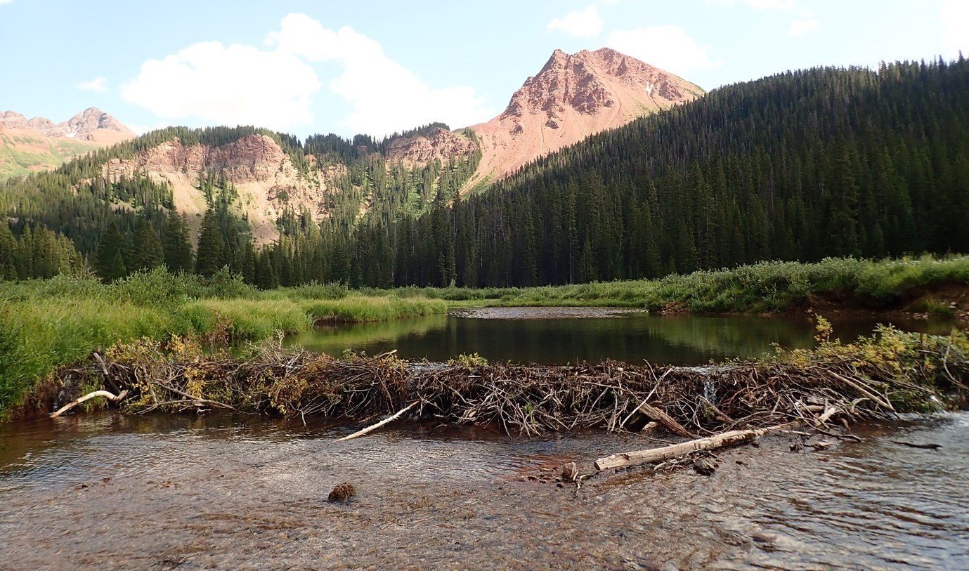
Beaver dam and pond in the headwaters of the Colorado River basin. Photo: Sarah Marshall, CNHP
The U.S. Fish and Wildlife Service (USFWS) tracks the status and trends of wetlands across the United States. The National Wetlands Inventory (NWI), maintained by USFWS, is a nation-wide map of wetlands that has been created over several decades by multiple different mapping partners. The dataset is incredibly valuable but does not track changes over time and the age of the data is variable across the West.
This is the first project of its kind, wherein the research team will use state-of-the-art remote sensing and machine learning techniques to map the extent of wetlands in the valley bottoms as well as the presence of beaver ponds and their changes over time. The work will provide a region wide audit of wetland coverage across the valley floor adding to the more detailed mapping information currently available in many areas through NWI.
The mapping and analysis will be carried out using high resolution 4-band aerial photography from the National Agriculture Imagery Program (NAIP) and LiDAR acquired by the government between 2006 and 2021.
Deep learning algorithms will be developed to identify and classify wetland areas and detect beaver ponds from the data available over multiple time periods throughout the basin.
“Deep learning is a subset of machine learning that uses artificial neural networks to learn complex and intricate patterns in large data sets. We will use supervised learning to detect and classify beaver ponds and wetlands within the river basin with multiple machine learning models developed to account for landscape differences across the river basin” says Matt Lythe, Managing Director of Lynker Analytics.
CNHP’s team of wetland ecologists will provide direct human-model training using local knowledge of these complexes and conduct a field survey in several areas to ground truth the system and measure accuracy. “Beaver ponds have a characteristic morphology and signature in multi-spectral imagery which lends itself to supervised learning.” adds Dr. Sarah Marshall, Ecohydrologist at CNHP.
Beaver ponds identified for model training using NAIP false color imagery
Scheduled for completion in May 2022, this project aims to produce an evidence-based analysis of wetland coverage and beaver activity over the past decade and enable monitoring to be carried out long term as imagery and LiDAR data are acquired.
The work will give the Walton Family Foundation Environment Program, scientists, and policy officials a more detailed understanding of wetland extent across the basin and enable further investigation of changes in the environment due to climate and human impacts over time.


